

Boulder Skyline Traverse
Type II Fun + A More Fun Edit

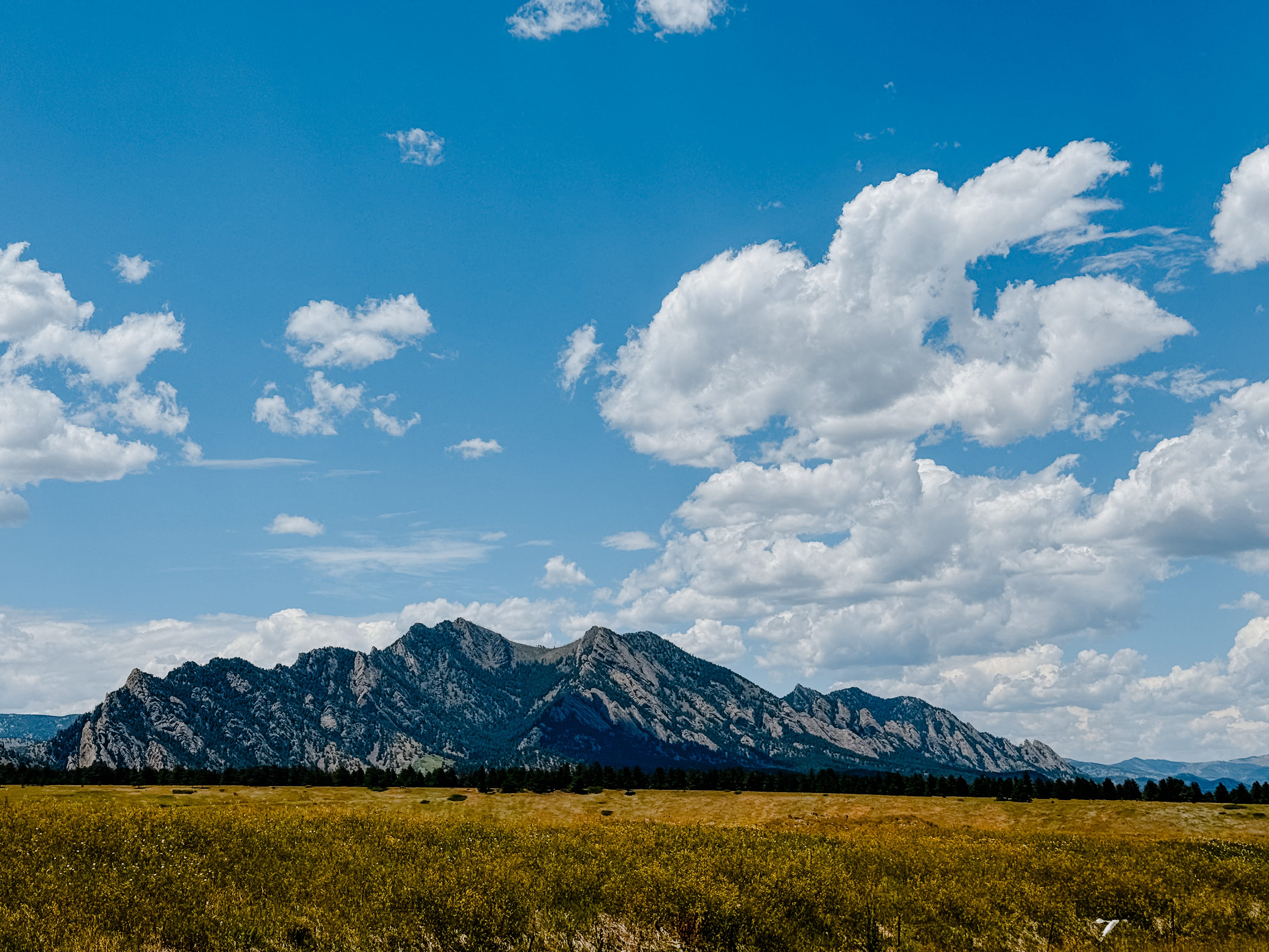
My alarm blared at 3 am, but I was already awake. I had been for almost an hour. My friend Dani and I were going to run the Boulder Skyline Traverse, an 18-ish mile, 6,000’ foot gain iconic traverse of the five peaks you see from Downtown Boulder and the surrounding area. Some cities have skyscrapers — Boulder has South Boulder Peak, Bear Peak, Green Mountain, Flagstaff Mountain, and Mount Sanitas.
Dani and I had run the Jemez Mountain 50K a month before, so we already knew how to find joy in the suffering together. That day, we spent 12 hours battling pounding hail, howling wind, pissing rain, a lightning storm, and apparently, also, a nearby tornado. But still, we traveled 32.8 miles and 6,417 feet up and crossed that finish line with smiles.
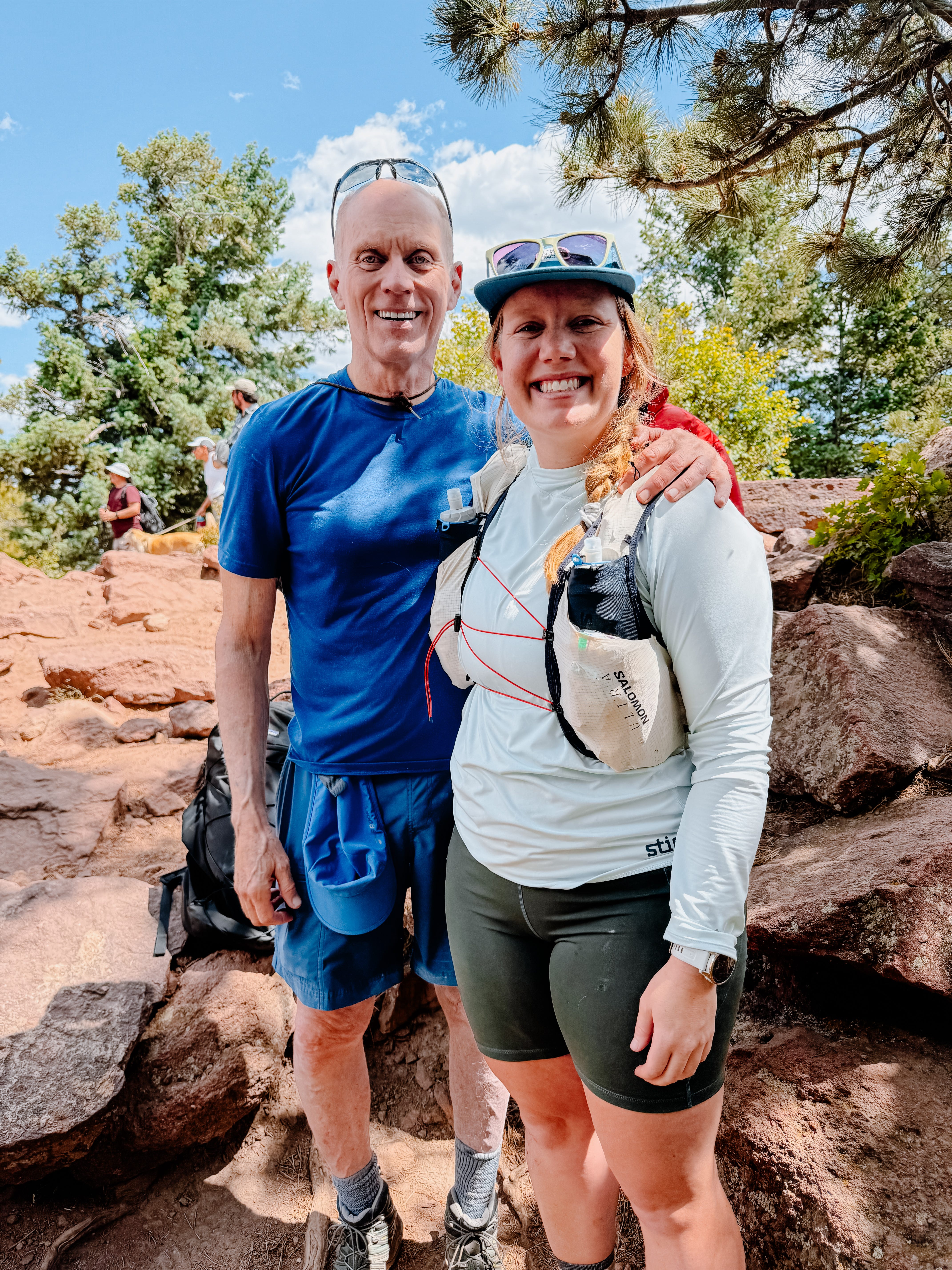
The Boulder Skyline Traverse is a bit of a rite-of-passage for Boulderites, and although I’ve never officially called Boulder “home,” my dad lived there for 10 years and I grew up nearby, so if not home — it feels like an extension of it. After Jemez, Dani and I knew that we wanted to adventure more together, so when I had a few extra days off work and plans to be in the Front Range for a concert anyway, we added “Boulder Skyline Traverse” to the calendar.
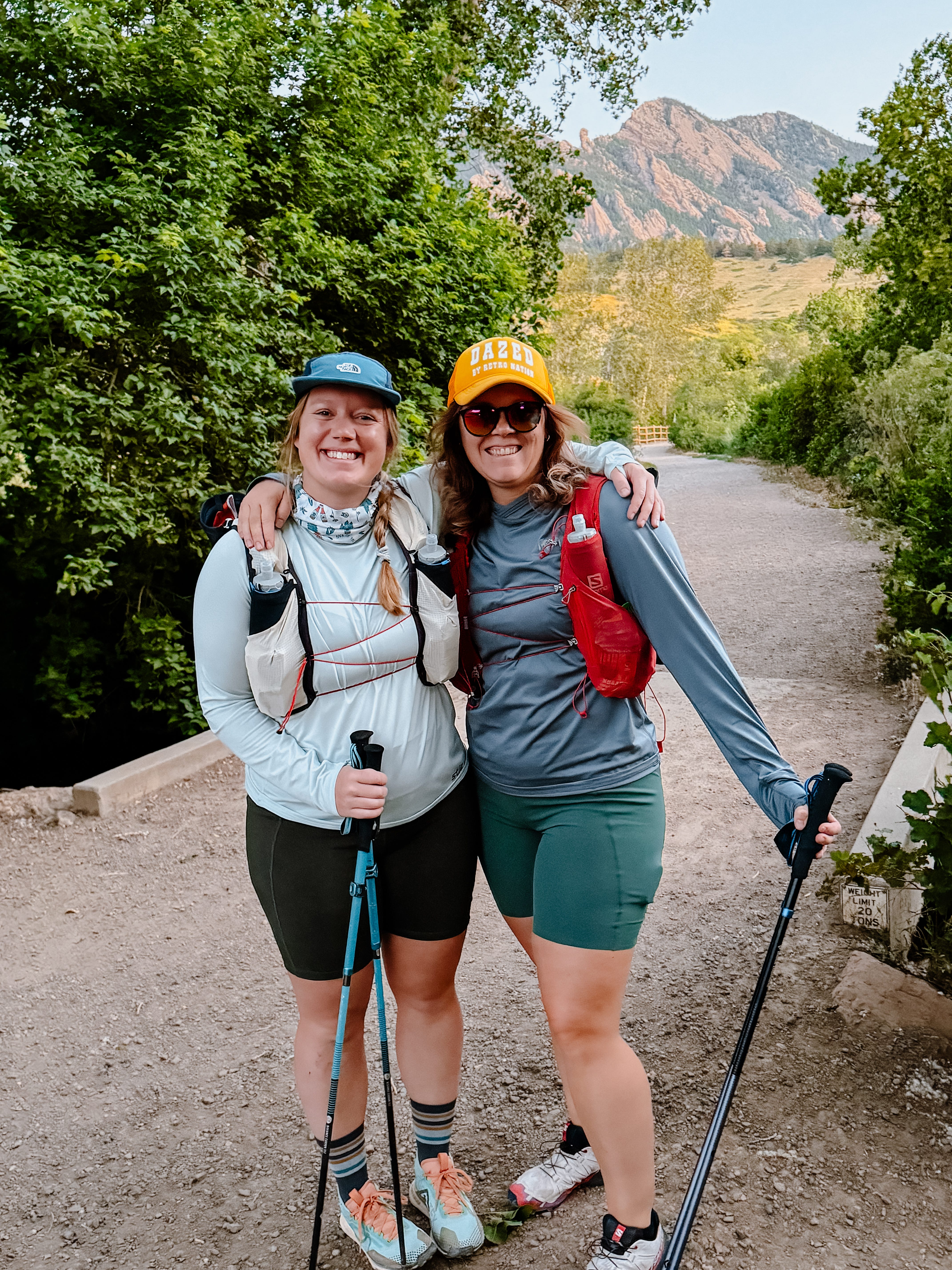
So there I was: peeling myself out of the cozy Airbnb bed at 3am on a Sunday. Coffee was poured, bagels were toasted, and snacks were gathered.
The traverse is typically done south-to-north, so you summit the tallest peaks first and have progressively easier climbs (and descents) as the day goes on. My dear ol’ dad offered to shuttle us to the start, so he picked us up from Mount Sanitas Trailhead as first light crept through the trees and we headed toward South Mesa Trailhead. We gave him a few water bottles and some snacks that he would pack up to us later in the day, grabbed a “before” pic, and headed up the trail.
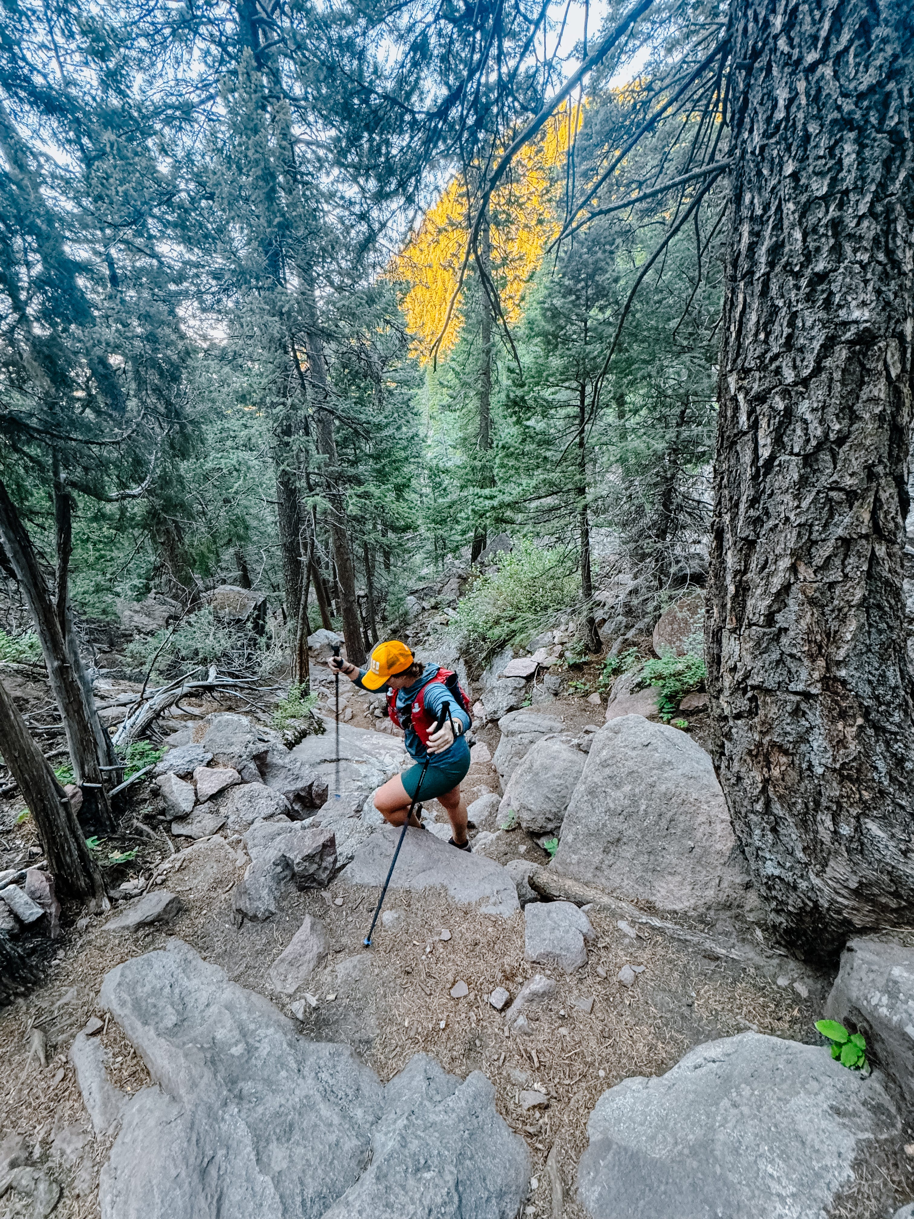
We warmed up with a gradual climb up a wide manicured trail, and then climbed steadily up Shadow Canyon. Regarded as the steepest climb in Boulder County, it gains 1,600 feet in one mile. As Jonathan Levitt (host of For the Long Run podcast) says, “Boulder average is having a shoe sponsor,” and Dani and I laughed every time we got passed by a group of elite runners talking about the latest FKT (Fastest Known Time) attempt they were training for.
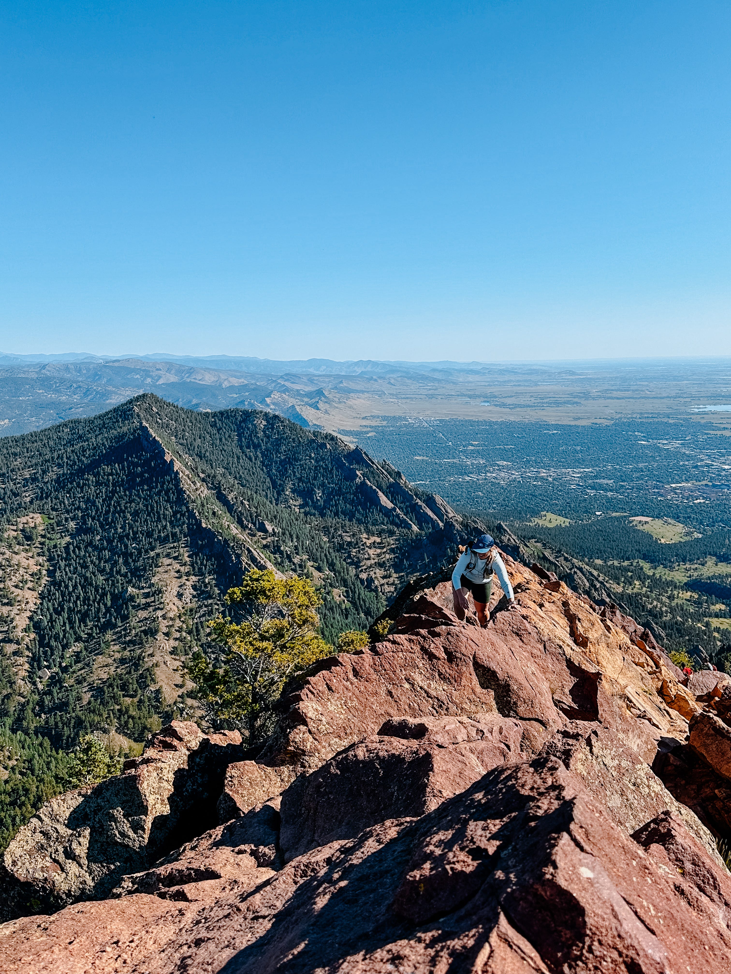
At the top of the climb, we headed to the summit of South Boulder — at 8,549 feet, it’s the highest point of the traverse and boasts unobstructed views of Rocky Mountain National Park, Longs Peak, and everything in between. We snapped a few pictures and then headed back to the saddle and up toward Bear Peak. The top of Bear is a Class II scramble with incredible views of the Flatirons, Boulder, RMNP, and the entirety of the Front Range. Ask Dani, and she’ll tell you about the numerous times I screamed, “this is fucking awesome!!!!!” as I picked my way over the boulders en route to the summit like a kid on their favorite ride at Disney.
From the top of Bear, we shimmied our way down to the West Ridge trail connecting us over to Green, and finally found some runnable, flowy miles. We met my dad at Bear Canyon and then cruised up the trail towards Green Mountain together. After a couple bites of an unfortunately stale PB&J and a fortunately delightful chocolate chip cookie, we said goodbye to my dad (who hiked down a different trail towards Chautauqua Park), and headed toward Flagstaff.
I’ll spare you the bulk of the details, but from the top of Green, it was downhill in more ways than one. The area around Flagstaff required a lot of route-finding, zigging-and-zagging, road-crossing, and more. The contrast from the elation on the top of Bear to the disappointment after Green was real.
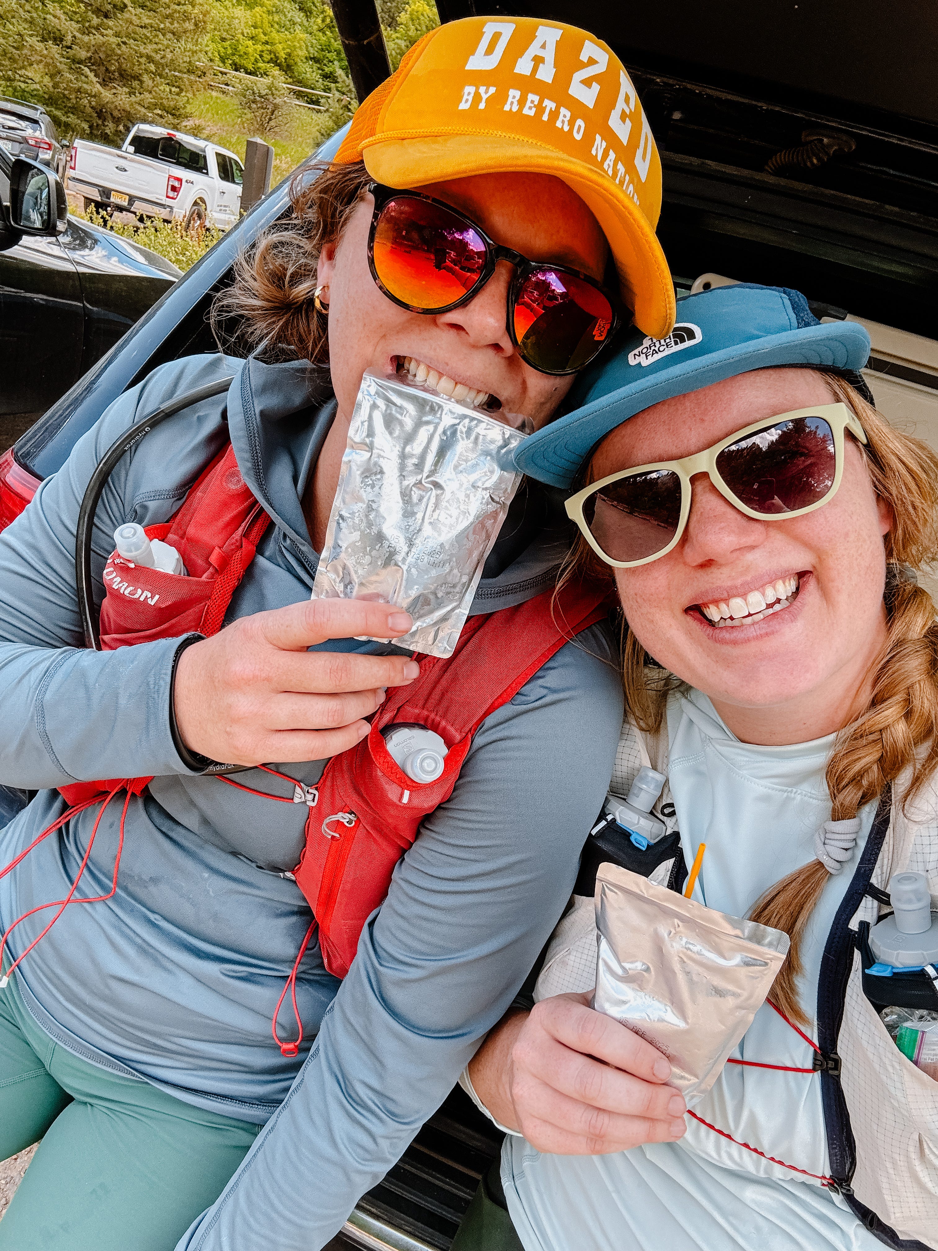
As the day wore on, our enthusiasm waned and the heat rose. We plodded down to Mount Sanitas Trailhead, sat on the back bumper of Dani’s Jeep, and hit “save” on our watches. We were done, and the remaining miles and vert of Mount Sanitas wasn’t worth the fun factor for us. It was a raging 95º and, with no shade on Sanitas, we knew the fifth peak wouldn’t add any joy to our day. Ending early meant that we got to preserve the good memories, shuttle my dad from Chautauqua back to his car at NCAR, and make it back to our Airbnb in time for a nap and a shower before a Back of the Pack meet-up at Sanitas Brewing. We didn’t run it, but we did drink it!
In the end, I’m stoked to have checked the Skyline Traverse off of my bucket list. Between the zigging and the zagging and the route-finding and the crowds from Green Mountain on, I wouldn’t do it again. But it’s iconic and rite of passage-y, and for that, I’d still recommend it to a Front Ranger.
I’m writing this from the “She Shed” of our Airbnb, where I have a peekaboo view of Bear Peak. That was our favorite part of the day, and I’m both proud and stoked that we stood up there. It feels really neat to look at the whole skyline and know that I crossed that on my own two feet. I didn’t get into trail running to be fast or stand on podiums. I got into trail running so that I could move faster in the mountains and do epic shit with my friends. Yesterday was a stand-out reminder that — even if it sucks sometimes, I’m on the right path. I guess that’s why they call it Type II Fun.


The Skyline Edit
Even if I wouldn’t do the full Boulder Skyline Traverse again, I would do part of it. The “Skyline Edit” route as I’m calling it starts similarly at South Mesa Trailhead, ascends Shadow Canyon to summit South Boulder and Bear Peak, traverses over to the summit of Green Mountain, and then — instead of continuing north toward Flagstaff, heads back to South Mesa Trailhead. In total, it’s just over 17 miles and 5,000 feet of gain. Same same, but different.
To me, this route hits the most scenic and prominent peaks while avoiding the not-so-fun-or-scenic aspects of the traverse.
Some technical specs for those who might want to do it:
I carried five 500mL flasks of water
There was a reliable creek in Bear Canyon between Bear Peak and before the climb up to Green Mountain — we did not need to filter water here, but could have
There is also water at Eben G Fine Park — we did not need to use this (thanks, Dr Dad, for carrying water up Green Mountain for us!)
We started at 5:45 am, but 5:00 am would’ve been more ideal (sunrise was 5:33 am)